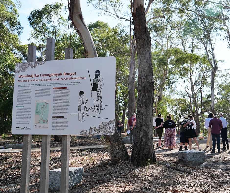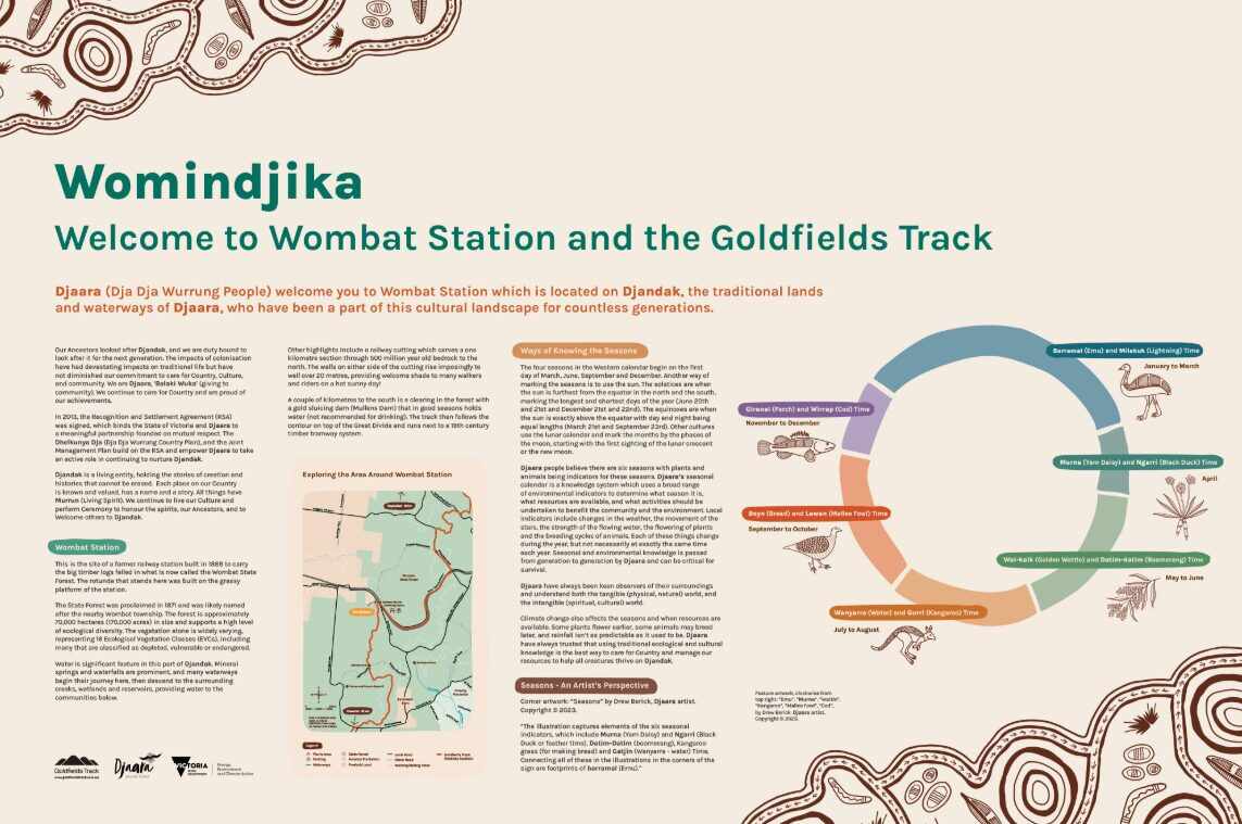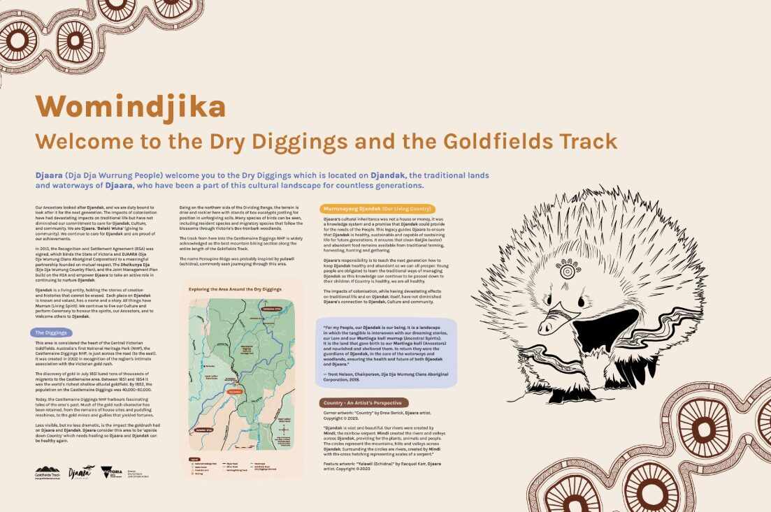

Stories of Aboriginal, European and Chinese heritage and more are bringing the Goldfields Track to life through a series of 58 interpretive signs, designed and installed by Dja Dja Wurrung enterprise DJANDAK for community organisation Goldfields Track Inc.
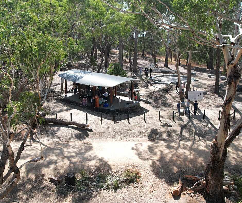
The Goldfields Track Visitor Ready Interpretation Project also features two new visitor nodes, complete with shelters and seating. A further two existing nodes have been refreshed with significant new signage, making four visitor nodes in total along the 210-kilometre walking and cycling trail from Mount Buninyong in Wadawurrung Country to Bendigo in Dja Dja Wurrung Country.
A significant feature of the project has been the partnership approach between Traditional Owners, DJAARA and Wadawurrung Traditional Owners Aboriginal Corporation, and Goldfields Track Inc, as well as the close collaborations with state and local governments, tourism bodies and other community representatives.
The trail is known as ‘The Goldfields Track’ – however, there is much more to this region than its gold-mining history.
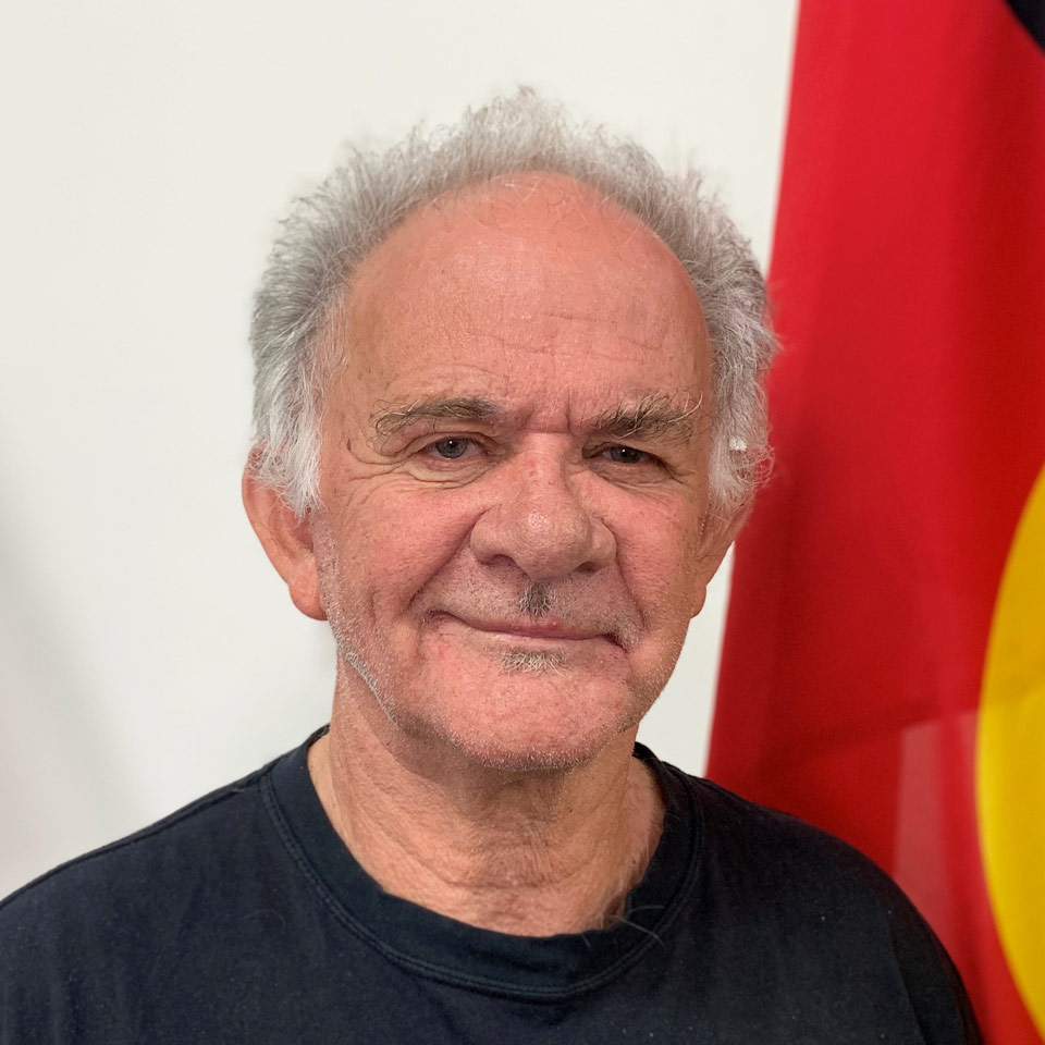
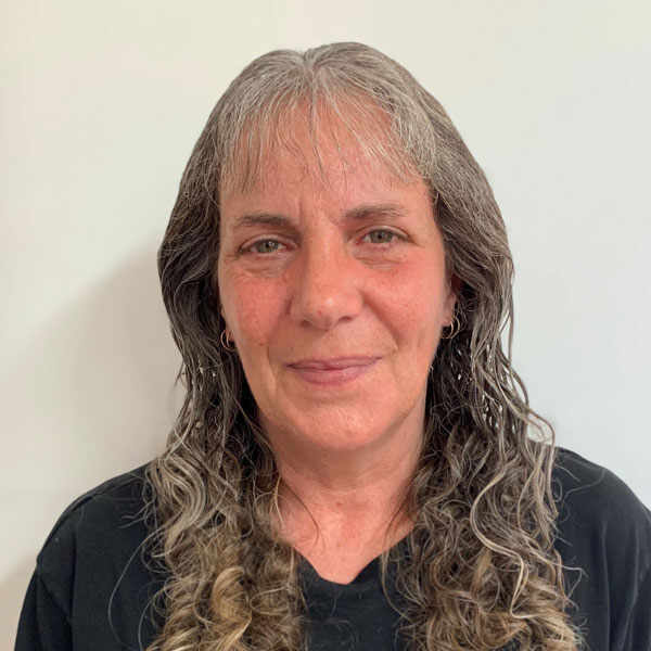
DJAARA Group CEO, Rodney Carter said the interpretive project has helped to reinstate Traditional Owners and Culture back into the landscape.
‘The beautiful signs along the track remind us that there were many people in this landscape, living and walking along this track, long before the gold rush. And, in fact, Aboriginal People are still here, still practising our culture in a contemporary way. It’s important those stories are told, alongside those of mining, geology and Country,’ Mr Carter said.
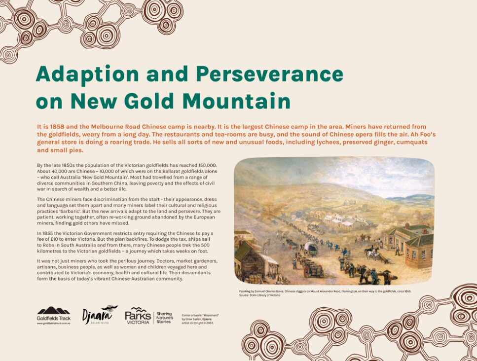
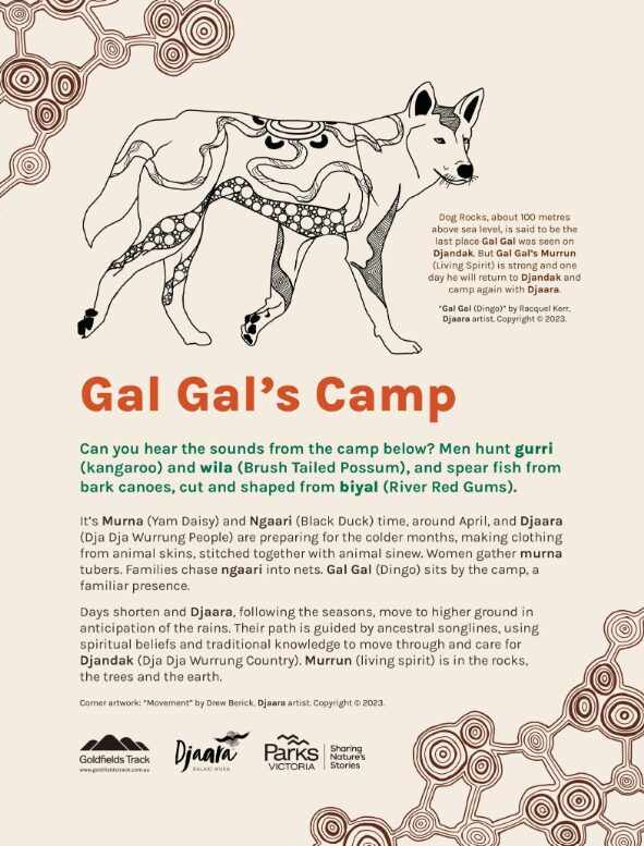
Visitors to the trail – be they locals walking the dog, or international visitors trekking the entire 210 kilometres – can learn about different ways people lived and interacted with the landscape. As an example, stories about water point to ancient fish traps, Indigenous plants and animals, the 19th-century engineering that brought water over the Great Dividing Range, environmental repercussions of mining on waterways, and the way Traditional Knowledge is being used to heal water today.
Even armchair travellers can read the stories and engage with the trail: the signs are also published on the Goldfields Track website: visit goldfieldstrack.com.au/understanding-country.
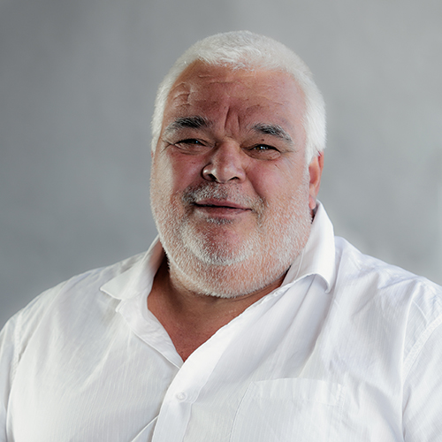
Noting the scale of the project, Chair of the Project Committee Peter Skilbeck highlighted the number of land managers and partners involved.
‘An immense amount of effort and time has been put into this unique multi-stakeholder project,’ Mr Skilbeck said.
‘It really shows in the beautiful signage and visitor nodes that have been created to allow people time to stop and learn more about the incredible history of our region.’
Mr Carter added: ‘The strong and respectful collaborative process has resulted in rich content and strong relationships with our partners. It’s a great outcome for all involved and a great outcome for everyone using the trail.’
The Goldfields Track Visitor Ready Interpretation Project was funded by the Victorian Government. It was officially launched in a ceremony at Leanganook camping area on 26 March.
Learn more about the Goldfields Track and the interpretive signage at goldfieldstrack.com.au